ZIYAN F15 + Riegl LiDAR Completes High-Precision Survey for Lake Restoration Project

2026-06-17
Lake restoration and wetland renovation projects often face challenging survey conditions, including soft silt foundations, inaccessible terrain, and complex and variable site environments. Traditional manual survey methods relying on RTK and total stations are unable to adapt to silt soft-ground scenarios, posing significant safety risks, low operational efficiency, and frequent data missing or deviation, which fail to meet the high-precision measurement requirements of water conservancy engineering construction.
To address the bottlenecks of complex wetland surveying,Ziyan Technology has successfully delivered a full-scale earthwork survey for a lake farmland-to-lake restoration project. Adopting the mature industrial UAV survey solution of Ziyan F15 long-endurance industrial UAV equipped with Riegl airborne LiDAR, the project team realized unmanned, one-flight full-coverage data collection in extreme silt soft-base working conditions.

Challenges of Complex Wetland Survey

The project area was transformed from fish ponds. After water drainage, the site was covered with thick silt and loose soil with extremely low ground bearing capacity, making it impossible for personnel and ground survey equipment to enter the construction area. In addition, the simultaneous earthwork excavation and transportation operations led to dynamically changing terrain and working conditions, placing high requirements on the environmental adaptability, flight stability and data accuracy of survey equipment.
Conventional manual surveys and ordinary UAV mapping solutions have obvious limitations in such scenarios. They cannot penetrate surface obstacles to acquire real terrain data, resulting in insufficient point cloud density and inaccurate earthwork calculation data, which seriously restricts project construction progress and acceptance.

Solution Advantages of Ziyan F15 + Riegl LiDAR

Tailored for harsh water conservancy and wetland working conditions, the combination of Ziyan F15 industrial UAV and Riegl high-precision LiDAR thoroughly breaks the limitations of traditional manual surveying. It supports stable unmanned operation in inaccessible and complex terrains, delivering high-precision and efficient 3D terrain data acquisition.
1. Long-endurance Operation for One-shot Full Coverage
The Ziyan F15 industrial UAV supports 1-hour stable continuous operation and a 30km operation radius. It completes full-coverage data collection of large-area sites in a single flight, effectively avoiding data errors and efficiency losses caused by multiple takeoffs, landings and data splicing. The 2km² project area was fully surveyed with only one flight, greatly improving operational efficiency and shortening the project cycle.
2. Outstanding Environmental Adaptability for Harsh Sites
Featuring flexible takeoff and landing, stable control and strong anti-interference capability, the Ziyan F15 requires no hardened runway. It adapts perfectly to muddy fields, complex terrain and various unattended working environments. In this silt soft-base lake restoration project, the UAV maintained stable flight throughout the whole process without site condition restrictions.
3. High-precision LiDAR Data Acquisition

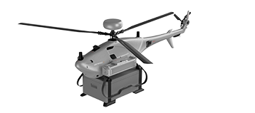
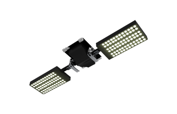
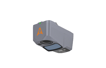
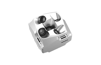
Equipped with Riegl airborne LiDAR, the system effectively filters interference from surface debris and shallow vegetation to capture real terrain data of silt layers and original soil layers. Operating at a flight altitude of 80m and a speed of 15m/s, the solution achieved a high point cloud density of 43 points/㎡. The complete and detailed 3D data fully meets the standards for earthwork calculation, 3D terrain modeling and project completion acceptance.


Riegl airborne LiDAR


Riegl airborne LiDAR


Project Achievements & Value

The entire project adopted an unmanned operation mode, completely eliminating safety hazards caused by on-site manual entry. With the excellent flight performance of Ziyan F15 and the high-precision sensing capability of Riegl LiDAR, full-coverage high-quality terrain data of the complex silt area was efficiently obtained in a single flight.
The delivered 3D point cloud models, terrain elevation data and earthwork measurement data accurately restore the original terrain and silt distribution of the project area. It provides reliable data support for earthwork planning, quantity calculation, construction optimization and project acceptance, winning high recognition from the client.
In the future, Ziyan Technology will continue to iterate industrial UAV system solutions with long endurance, strong environmental adaptability and high precision. Committed to empowering digital transformation of water conservancy engineering, ecological restoration, land surveying, infrastructure construction and other industries, Ziyan will provide efficient and reliable intelligent aerial survey solutions for global engineering projects.


Product Data Center
Please enter the UAV serial number
Download Data
Data need to be verified and downloaded
Download Data
Your Trusted UAV Provider
What We Provide
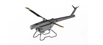
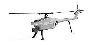
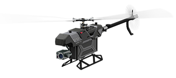
  • Small and Medium-sized UAVs

  • Industry-Proven UAV Solutions

  • Full-Customized Services

  • Flight Training Services

Contact Us
We'd love to hear from you! Please fill out the form below, and our team will respond within 1 day!
*Name
*Phone
*Company
*E-mail
*Country
*How did you hear about us?
*Message