


sales@ziyanuav.com
WhatsApp/Telegram: +85365521828


ZIYAN, a leading manufacturer of industrial unmanned helicopter platforms, successfully participated in the 2026 LiDAR Industry Applications Conference, held from March 4 to 6 in Shenzhen. In partnership with LiDAR technology provider GreenValley, ZIYAN demonstrated how the integration of advanced UAV platforms with precision LiDAR sensors is transforming spatial data acquisition for industries worldwide.
The event gathered experts from the fields of surveying, mapping, geospatial engineering, infrastructure inspection, and environmental monitoring, creating an important platform for showcasing the latest developments in UAV LiDAR mapping technology.
By combining high-performance unmanned helicopter platforms with advanced LiDAR solutions, ZIYAN continues to deliver efficient, reliable, and scalable aerial surveying solutions for complex professional applications.
Accurate spatial data is essential for industries such as surveying and mapping, infrastructure inspection, mining, forestry, and environmental monitoring. Traditional data collection methods often require extensive manpower, time-consuming ground operations, and significant operational costs.
UAV LiDAR mapping technology is rapidly changing this landscape.
By integrating stable UAV platforms with high-precision LiDAR sensors, organisations can collect geospatial data faster, safer, and more accurately than traditional surveying methods.
Compared with conventional surveying approaches, UAV LiDAR solutions offer several key advantages:
Rapid data collection across large and difficult terrains
High-precision point cloud generation
Reduced operational costs and manpower requirements
Safer operations in hazardous environments
Faster project turnaround time
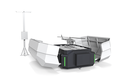
Through the collaboration between ZIYAN and GreenValley, customers can access a complete aerial LiDAR mapping solution, covering everything from data acquisition to data processing and analysis.
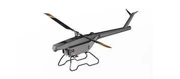
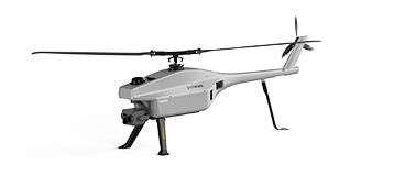
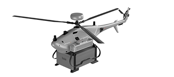
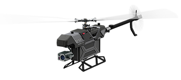
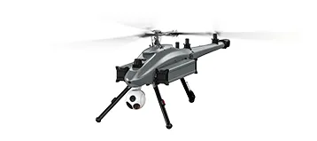
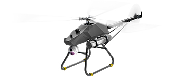
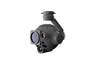
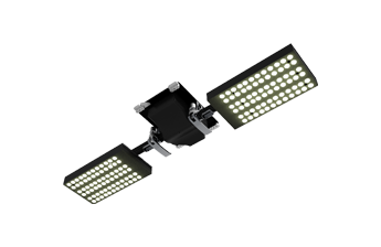
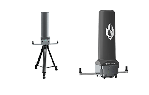
A highlight of the exhibition was the ZIYAN F15 Unmanned Helicopter, a professional electric UAV platform specifically designed for high-precision aerial surveying and LiDAR mapping missions.
Unlike many traditional drones, the F15 adopts a single-rotor electric helicopter design, providing excellent flight stability, strong wind resistance, and higher payload capacity. These characteristics make it particularly suitable for demanding industrial applications.
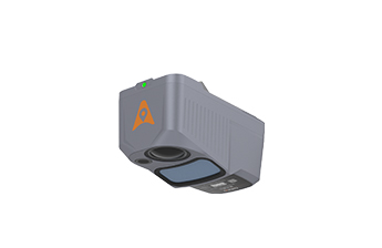
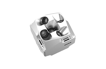
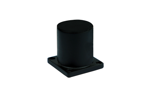
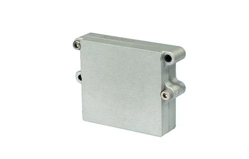
By integrating GreenValley’s advanced LiDAR systems, the F15 provides a powerful and flexible platform capable of supporting multiple mapping sensors and delivering highly accurate spatial data.
Feature
Specification
Operational Benefit
Extended Endurance | Up to 100 minutes | Enables long-duration mapping missions and large-area coverage |
Payload Capacity | 5 kg | Supports LiDAR sensors and multi-sensor payload configurations |
Wind Resistance | Beaufort Level 8 | Maintains stable data collection in challenging weather conditions |
Integrated Solution | One-stop LiDAR mapping workflow | Simplifies surveying operations |
Rapid Deployment | Automated mission planning | Improves operational efficiency and reduces preparation time |
These capabilities make the F15 unmanned helicopter a highly effective tool for a wide range of professional applications, including:
Topographic surveying and mapping
Forestry resource monitoring
Power line and infrastructure inspection
Mining and geological surveying
Environmental monitoring and land management
Disaster assessment and emergency mapping
With its strong endurance and payload capability, the F15 enables surveying teams to conduct large-scale aerial mapping missions more efficiently than ever before.
Beyond showcasing technology, the conference also provided opportunities for meaningful discussions with industry professionals about the practical value of UAV surveying solutions.
Organisations that adopt UAV LiDAR mapping technologies can achieve significant operational improvements, including:
Reduced surveying time
Lower operational costs
Higher data accuracy and consistency
Faster decision-making through real-time data collection
For surveying companies, engineering firms, and infrastructure operators, these advantages translate into measurable improvements in productivity and return on investment (ROI).
Through ongoing technological innovation and industry partnerships, ZIYAN continues to support customers worldwide with reliable aerial data acquisition platforms designed for real-world operational demands.
The 2026 LiDAR Industry Applications Conference once again highlighted the rapid growth of UAV technologies in the geospatial industry.
As industries increasingly rely on accurate spatial data for planning, monitoring, and infrastructure management, UAV-based LiDAR mapping solutions are becoming an essential tool for modern surveying operations.
With its expertise in electric unmanned helicopter platforms, ZIYAN remains committed to advancing UAV technologies that enable safer, more efficient, and more precise aerial data collection.
By continuously improving UAV performance and expanding system integration capabilities, ZIYAN aims to help industries around the world unlock the full potential of spatial intelligence and digital mapping technologies.
For more information about ZIYAN UAV surveying and mapping solutions, please visit:
https://www.ziyanuas.com
 sales@ziyanuav.com
 Unit 101, building 2, Zhongdian high tech Industrial Park, Keji seventh Road, Tangjiawan Town, Xiangzhou District, Zhuhai, Guangdong, China


Small and Medium-sized UAVs
Industry-Proven UAV Solutions
Full-Customized Services
Flight Training Services


