


sales@ziyanuav.com
WhatsApp/Telegram: +85365521828


But if you work in utilities, you already know the real question:
How do you inspect power lines in mountains without burning time, people, and batteries?
I'm talking about:
High-altitude terrain
Wild weather shifts
Transmission corridors that run forever
Teams constantly stopping, swapping batteries, and restarting missions
That's the daily reality for power grid inspection.
And that's exactly what this test in Yunnan was built to deal with.
Let's be honest.
Most small multi-rotor power line inspection drones weren’t designed for long-distance work.
Here's what usually happens:
You fly 3–5 km
You land
You swap batteries
You move the team
You restart the mission
Do that enough times and:
Data continuity breaks
Shift handovers create gaps
Efficiency drops fast
In mountainous terrain, those problems get worse.
Steep elevation changes.
Wind tunnels.
Limited takeoff points.
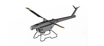
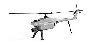
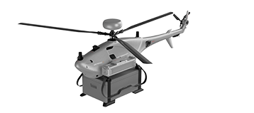
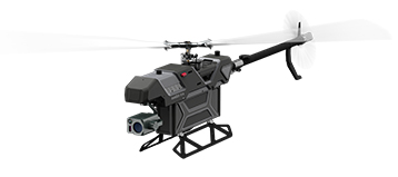
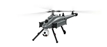
That's the gap the F15 unmanned helicopter is meant to fill.
Instead of forcing small drones to do big-drone work, ZIYAN took a different route.
We deployed the F15 UAV, a long-endurance electric unmanned helicopter built for range, payload, and stability.
Here’s what made the difference:
Long-distance flight without constant stops
Stable performance in high-altitude environments
Enough payload capacity for serious LiDAR work
No hacks.
No workarounds.
Just the right tool for the job.

This wasn't a lab test.
It was real-world power grid inspection across Yunnan, China.
Test conditions:
Route length: ~40 km
Elevation range: 1,800 m to 3,200 m
Terrain: mountainous, complex, unpredictable
The goal was simple:
Cover more ground.
Collect better data.
Reduce operational friction.
This is where the numbers start to matter.
The F15 UAV delivers:
Up to 100 minutes maximum endurance
5 kg payload capacity
Over 60 minutes of effective flight time with LiDAR onboard
What that means in practice:
20–30 km of power line covered in a single sortie
Fewer takeoffs and landings
Fewer human errors
Massive efficiency gains
Compared to traditional multi-rotor UAV inspection, this changes the workflow completely.
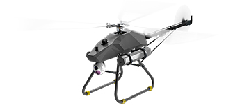
High-altitude UAV operations aren’t forgiving.
The F15 was engineered with:
Multi-redundant flight control
High-resilience propulsion
Stable attitude control above 3,000 m
Wind performance:
Takeoff and operation in Level-7 winds
Survivability up to Level-8 winds
That’s the difference between cancelling a mission and getting it done.
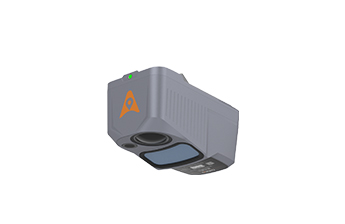
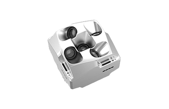
Hardware only matters if the data holds up.
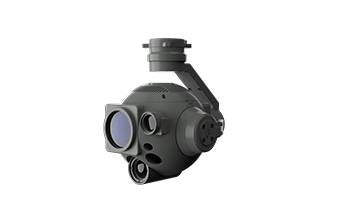
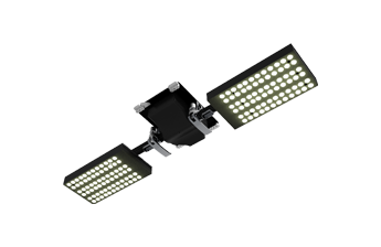
The LiDAR power line inspection system on the F15 delivers:
Dense point clouds
High-accuracy 3D imaging
Reliable data even at higher flight speeds
This enables:
Accurate 3D reconstruction of transmission corridors
Faster identification of clearance risks and structural issues
Cleaner datasets for post-processing
Less noise.
Less guesswork.
More confidence.

Let's get specific.
During a single flight, the F15:
Flew over 60 minutes effectively
Collected 42+ km of 3D corridor data
Achieved 177 pts/m² point-cloud density
Compared with conventional multi-rotor UAVs:
36% improvement in data quality
More than 4× operational efficiency
That's not incremental improvement.
That's a different category of performance.
This test proves something important.
Long-distance, high-altitude power line inspection UAV operations don’t need to be painful.
With the right platform:
Fewer crews are needed
Missions run longer and cleaner
Data becomes more reliable
That's how inspection teams move from manual-heavy workflows to data-driven, intelligent power grid inspection.
The Yunnan deployment opens a new technical pathway.
Not just for one region.
But for any power grid facing:
Mountains
Long transmission corridors
Harsh weather
ZIYAN will continue working with industry partners to push intelligent, automated UAV inspection further.
Because efficiency isn’t about flying faster.
It's about flying smarter.
Yes.
The F15 maintains stable flight above 3,000 m and is designed specifically for high-altitude terrain.
With LiDAR onboard, the F15 can inspect 20–30 km of transmission lines in a single sortie.
Longer endurance.
Higher payload capacity.
Better stability in wind and altitude.
Absolutely.
The platform is optimized for high-performance LiDAR payloads and dense point-cloud data collection.
F15 UAV power line inspection isn't about hype.
It's about solving real inspection problems in real terrain.
 sales@ziyanuav.com
 Unit 101, building 2, Zhongdian high tech Industrial Park, Keji seventh Road, Tangjiawan Town, Xiangzhou District, Zhuhai, Guangdong, China


Small and Medium-sized UAVs
Industry-Proven UAV Solutions
Full-Customized Services
Flight Training Services


