


sales@ziyanuav.com
WhatsApp/Telegram: +85365521828


Highways are the arteries of national economic growth. Every day, billions of vehicles move across these critical routes, driving trade, logistics, and connectivity. Behind this massive flow lies a constant challenge — ensuring the safety, stability, and health of increasingly complex highway networks.
Traditional inspection methods depend heavily on manual patrols and vehicle-based monitoring. These methods are labour-intensive, time-consuming, and limited by weather, visibility, and human constraints. As global highway infrastructures expand, the demand for smarter, faster, and safer highway inspection solutions has never been stronger.
The rise of unmanned aerial systems is redefining roadway management. UAVs offer high mobility, rapid deployment, and real-time data acquisition — enabling authorities to detect risks before they escalate.
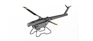
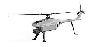
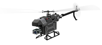
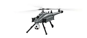
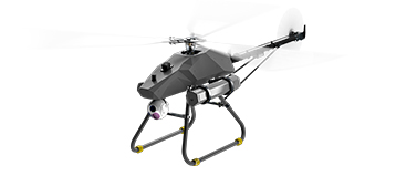
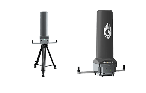
And at the forefront of this evolution stands the F15 UAV.

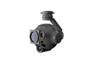
The F15 UAV is a long-endurance, all-weather unmanned aerial system engineered to deliver high-efficiency, high-precision highway monitoring. With exceptional wind resistance, long flight time, and advanced automation, it serves as a reliable aerial guardian for modern transportation networks.
Long-endurance, high-speed flight for covering extensive highway segments
Strong wind resistance & all-weather capability
Autonomous mission planning and rapid deployment
High stability for complex inspection tasks
These capabilities make the F15 a powerful upgrade from traditional patrols — enabling real-time, data-driven highway management.
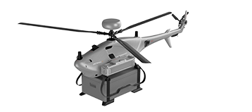
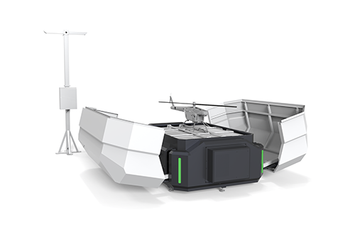
A fully intelligent inspection system requires more than UAV hardware — it needs an automated ecosystem.
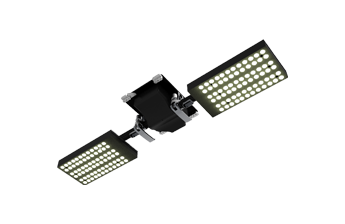
The F15 UAV Docking Station delivers exactly that.
Each docking station provides:
Automatic precision landing
Automated battery charging
Real-time data transmission
Remote mission scheduling
24/7 autonomous inspection
Just 2–3 stations can monitor an entire 100 km highway segment, dramatically reducing manual workload and enabling truly continuous inspection.

Highway environments vary — mountains, tunnels, coastal regions, or remote rural stretches. The F15 is built to maintain stable communication anywhere.
Radio link
4G module
Relay transmission
This ensures uninterrupted connectivity during long-range missions and in areas with limited network coverage.

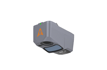
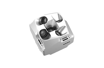
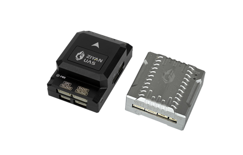
The F15 UAV supports an open SDK ecosystem that empowers integrators and highway authorities to personalise inspection workflows.
PSDK: Custom payloads, sensors, and inspection tools
GSDK: Software integration with local management platforms
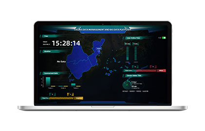
Cloud API: Direct connection to cloud-based analytics or digital twin systems
This modular design allows the F15 to support diverse highway operations, including:
Road surface damage detection
Slope collapse or landslide monitoring
Bridge inspections
Nighttime patrols
Emergency response
The F15 UAV shifts highway inspection from manual, reactive maintenance to automated, predictive management.
By combining:
High-resolution aerial imaging
AI-powered analysis
Real-time alerts
Authorities can detect cracks, structural weaknesses, waterlogging, landslide risks, or surface anomalies before they develop into major failures.
Reduced manpower dependency
Lower inspection costs
Faster response time
Higher road safety
Improved asset lifetime
With the integration of systems like the F15 UAV, highway management becomes:
Autonomous
Data-driven
Predictive
Efficient
The F15 UAV Highway Inspection Solution brings a new standard to national transportation infrastructure — where highways are monitored continuously, intelligently, and economically.
The future is here — and the F15 is leading the way.**
 sales@ziyanuav.com
 Unit 101, building 2, Zhongdian high tech Industrial Park, Keji seventh Road, Tangjiawan Town, Xiangzhou District, Zhuhai, Guangdong, China


Small and Medium-sized UAVs
Industry-Proven UAV Solutions
Full-Customized Services
Flight Training Services


